Welcome to the Nanango State Electorate
Visit communities in the electorate

Community Links


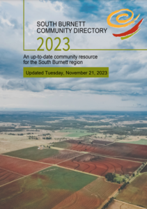 Click here to download the South Burnett Community Directory PDF
Community Support
Connect with your local member on the topics that matter most in Nanango Community.
About This Community
The state electorate of Nanango has an approximate area of 18,000 km².
It is comprised of 158 suburbs including Abbeywood, Alice Creek, Atkinsons Dam, Barker Creek Flat, Barlil, Benair, Benarkin, Benarkin North, Black Snake, Blackbutt, Blackbutt North, Blackbutt South, Boonara, Braemore, Brooklands, Bryden, Bullcamp, Byee, Caboonbah, Chelmsford, Cherbourg, Cherry Creek, Cloyna, Coal Creek and Coalbank plus parts of another 4 suburbs.
It is comprised of 46 localities including Anduramba, Avoca Vale, Ballogie, Barambah, Biarra, Booie, Boondooma, Booubyjan, Boyneside, Brigooda, Buaraba, Chahpingah, Charlestown, Cinnabar, Colinton, Dangore, Dundas, Durong, Emu Creek, Eskdale, Gordonbrook, Harlin, Ironpot, Jimna and Kilkivan plus parts of Bunya Mountains.
It is comprised of the councils of Cherbourg and South Burnett plus parts of Gympie, Somerset and Toowoomba Region.
It is surrounded by the state electorates of Callide, Condamine, Glass House, Gympie, Lockyer, Maryborough, Moggill, Pine Rivers and Warrego.
It is comprised of parts of the federal electorates of Blair, Flynn, Maranoa and Wide Bay.