Welcome to the Southern Downs Community Electorate
Community Links


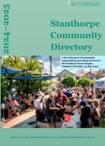 Click here to download the Stanthorpe Community Directory PDF

Community Support
Connect with your local member on the topics that matter most in Southern Downs Community.
Health
Contact Your MP about this
Education
Contact Your MP about this
Community Groups
Contact Your MP about this
Environment
Contact Your MP about this
Youth & Family
Contact Your MP about this
Emergency
Contact Your MP about this
About This Community
The state electorate of Southern Downs has an approximate area of 31,000 km².
It is comprised of 115 suburbs including Allan, Allora, Amiens, Applethorpe, Bapaume, Berat, Bony Mountain, Broadwater, Canningvale, Cannon Creek, Cherry Gully, Clintonvale, Clontarf, Condamine Farms, Cottonvale, Cunningham, Cypress Gardens, Dalcouth, Danderoo, Deuchar, Diamondvale, Domville, Ellinthorp, Eukey and Fletcher plus parts of another 3 suburbs.
It is comprised of 67 localities including Ballandean, Beebo, Billa Billa, Bonshaw, Boondandilla, Bringalily, Brush Creek, Bulli Creek, Bungunya, Bybera, Calingunee, Callandoon, Canning Creek, Captains Mountain, Cattle Creek, Cement Mills, Condamine Plains, Coolmunda, Dalveen, Daymar, Dunmore, Elbow Valley, Emu Vale, Glenarbon and Glenlyon plus parts of another 4 localities.
It is comprised of the councils of Goondiwindi and Southern Downs plus parts of Toowoomba Region.
It is surrounded by the state electorates of Condamine, Lismore, Lockyer, Northern Tablelands, Scenic Rim and Warrego.
It is within the federal electorate of Maranoa.